Mountain Bike Trails Near Me: How to Find, Evaluate, and Plan Rides in Knoxville’s Urban Wilderness
Mountain Bike Trails Near Me: How to Find, Evaluate, and Plan Rides in Knoxville’s Urban Wilderness
Key Points
- Trail-finder tools like Trailforks and MTB Project give you searchable access to thousands of trail systems, with AMBC being the perfect solution for East Tennessee searches, but knowing how to filter results is what separates a good ride from a wasted drive.
- Knoxville’s Urban Wilderness holds 50+ miles of connected singletrack in South Knoxville, with Baker Creek Preserve and Ijams Nature Center both reachable from The Drop Inn without loading bikes into a car.
- Evaluating a trail system before you go means looking at difficulty ratings, trail surface conditions, seasonal closures, and what’s within reach when you’re done riding.
- A good home base for a destination ride is close to the trailhead, has somewhere to clean up properly, and puts you near food and a real bed — the Urban Wilderness delivers all three without compromise.
- The urban trail plus city combination is rare: ride in the morning, eat and drink in South Knoxville or downtown at night, no tradeoff required.
Travel Log
This guide covers the full process of finding, evaluating, and planning rides at mountain bike trail systems — from the apps you use to scout routes to the questions worth asking before you load the truck. It’s built for riders who plan their trips around trail access, whether they’re chasing a local lap or mapping out a multi-day destination ride. Knoxville’s Urban Wilderness gets specific attention because the network surprises most people who didn’t know it was there: 50+ miles of singletrack across multiple connected parks, all accessible from South Knoxville, all within a few miles of a legitimate food and drink scene. If you’re searching for mountain bike trails near you and your search lands anywhere near East Tennessee, keep reading.
How to Find Mountain Bike Trails Near You
The first step is the same whether you’re riding at home or scouting a trip three states away: get into a trail database and start filtering. Two tools dominate the mountain bike community, and both are worth having on your phone.
Trailforks and MTB Project (now part of the REI Co-op) are the most widely used platforms for finding mountain bike trails near you. MTB Project skews toward accessibility and ease of use, with clean maps and crowd-sourced condition reports. Trailforks has deeper data, more granular difficulty breakdowns, and is the preferred tool for riders who want to know exactly what they’re getting into before they arrive. Both are free at the basic level.
Search by location, then filter by difficulty. Most platforms use a color system borrowed from ski resorts: green (beginner), blue (intermediate), black (advanced), and double black (expert). These ratings are community-set and somewhat subjective. A black trail in one region can ride like a blue in another, depending on local trail culture and the population doing the rating. Pay attention to user reviews and condition logs, not just the color code.
A few other resources worth knowing:
- Singletracks.com: Strong on written trail descriptions and area guides, good for pre-trip research.
- Komoot: Route-planning focused, useful for building multi-trail days and exporting to GPS.
- Local club websites and Facebook groups: Often have the most current intel on trail conditions, closures, and new construction that hasn’t made it into the databases yet.
- AllTrails: Primarily a hiking app, but covers many dual-use trails and is useful for beginner-friendly options.
If you’re riding in Knoxville, or trying to decide whether it’s worth the drive, start with the Appalachian Mountain Bike Club. AMBC is our local chapter of the Southern Off-Road Bicycle Association (SORBA), and they’re the reason this city rides the way it does: more than 80 miles of trail across Knox County, with over 50 of those miles sitting within two miles of downtown. That combination is rare. Most destination riding makes you choose between good trail and a decent place to land afterward. Here you can roll out of bed, ride, and be back before your coffee gets cold.
Their trail status page is updated daily and tells you what’s open, what’s closed for wet conditions, and what’s temporarily shut down for construction. No national database will have that. Check it the morning you ride, not the week before. And keep in mind those 80 miles exist because volunteers show up and dig them, so if you ride here, join AMBC or come out to a work party.
The search tools get you to the right geography. The next step is knowing what to look at once you’re there.
What to Look for When Evaluating a Trail System
Finding a trail is easy. Knowing whether it’s worth the drive is a different skill. A good trail system evaluation takes about ten minutes if you know where to look.
Difficulty distribution matters more than the headline rating. A trail system rated “intermediate” on paper might have three beginner-friendly flow trails and a technical black that nobody warned you about. Look at the full breakdown: how many trails are in each difficulty tier, and what percentage of the total mileage is accessible to your skill level. Trailforks displays this as a pie chart by trail count and by mileage, which is genuinely useful.
Trail surface and construction quality is the next thing to check. Hand-built natural trails have a different character than machine-built flow trails, and neither is better in every context. What matters is whether the surface matches what you’re riding. Loose-over-hard (rocky or rooty trails that look rideable but get slippery when dry) and hardpack dirt both require different tires and technique. Knowing in advance saves you from showing up on the wrong setup.
Seasonal availability and current conditions are non-negotiable research steps. Many trail systems in the Southeast are soft and fragile in wet conditions — riding them wet causes real damage and often violates trail etiquette. The freeze-thaw cycle in East Tennessee is worth understanding: after a hard freeze, trails can feel firm in the morning and turn soft by mid-afternoon as the ground thaws. Check condition reports on MTB Project or Trailforks before you go, and check the morning of the ride again. AMBC posts closures on their website and social channels within hours of a significant rain event. When in doubt, wait a day.
Here’s a quick reference for what to verify before committing to a destination ride:
What to research before you ride
| Factor | Where to check | What to look for |
|---|---|---|
| Difficulty ratings | Trailforks, AMBC, MTB Project | Match to your skill level across the full trail list |
| Current conditions | AMBC website | Recent rain? Trail soft? Any closures? |
| Trail length and elevation | Trailforks, AMBC, Komoot | Total mileage, climbing per loop |
| Parking and access | Google Maps, AMBC website | Lot size, fee or permit required |
| E-bike access | Trailforks trail detail page | Allowed, restricted, or prohibited per trail |
| Season and best time to ride | AMBC or local trail association | Peak season, mud season, snow closure |
That last column — season and timing — is worth spending a minute on. East Tennessee trails ride well from spring through fall, with the shoulder seasons (March/April and October/November) often delivering the best conditions: cool temperatures, firm dirt, and thinner crowds than summer. Summer afternoons can push into the 90s°F (32°C+), which makes early morning starts worth the alarm.
How to Plan a Destination Mountain Bike Trip
Planning a destination ride is a different kind of logistics than a local lap. You’re coordinating travel, accommodations, trail access, and usually at least a few meals that matter — all around a ride window that depends on weather and trail conditions you don’t fully control.
Start with the trail system, then build everything else around it. Most riders make the mistake of booking lodging first and hoping the trails are close enough. The better approach is to identify the specific trailhead or access point, then search for lodging within a short drive. Under 15 minutes from the trailhead is the sweet spot: close enough for a second loop without losing half an hour each way in the truck. In Knoxville, the Urban Wilderness trail network makes this math simple — The Drop Inn sits 0.7 miles from Baker Creek Preserve, with direct trail connectivity that means bikes stay off the car entirely.
What to look for in a home base:
- Proximity to the trailhead: Walk or short drive, not a 30-minute haul with bikes loaded on the car.
- Bike-friendly facilities: A place to wash down a muddy bike, secure storage overnight, and enough space to work on it if something needs attention.
- A real shower and a real bed: This sounds obvious but matters more after a long day than it does during the planning phase. Soaking tub access is a genuine luxury after a technical ride.
- Food within reach: You won’t want to drive 45 minutes for dinner. Knowing what’s walkable or a short drive away before you book saves frustration later.
- A flexible checkout or check-in: Ride windows shift with weather. A property that’s reasonable about late starts or early arrivals is worth something.
Gear logistics deserve their own moment in the plan. Verify that your vehicle setup can handle the bikes, that you have a floor pump and basic tool kit, and that there’s a bike shop within reasonable distance of the trail in case something goes sideways. Most destination riders traveling more than two hours will also want to check whether the trail system has any rental options for guests who might be joining mid-trip without their own equipment.
A Sample Multi-Day Knoxville Itinerary
A two- or three-day mountain biking trip through Knoxville’s Urban Wilderness is easy to build around progression, variety, and recovery. Start day one at Baker Creek Preserve, then connect to Marie Myers Park and William Hastie Natural Area to experience some of the area’s most popular flow trails, climbs, and wooded singletrack. On day two, take on the South Loop by following the Urban Wilderness logo blazes through a 12.5-mile route that links several parks and showcases the diversity of the entire corridor. If you’re staying a third day, explore the winding singletrack at Fort Dickerson before slowing the pace with an afternoon at Augusta Quarry, a perfect spot to swim, relax, or simply recover after a few days on the trails. Each evening, South Knoxville or downtown is just a short drive away, and Kern’s Food Hall, only minutes from The Drop Inn, is a reliable place to refuel before the next day’s ride.
Reading Difficulty Ratings Like a Local
Difficulty ratings are guidelines, not guarantees. The more trail systems you visit, the faster you’ll learn to read past the color codes and into the actual character of a trail.
Green trails are generally machine-built flow with wide berms, gentle grades, and minimal technical features. Blue trails introduce roots, rocks, short steep sections, and features that require some commitment. Black trails vary enormously: some are technical but slow (tight switchbacks, off-camber lines), others are fast and consequence-heavy (exposure, big drops, high-speed chutes). Double blacks are for riders who know what they’re doing and accept the result if they don’t.
The real variable is local consensus. Trail communities in different regions develop their own rating cultures, and a “black” trail in a region with a conservative rating community might be a solid blue anywhere else. The best calibration tool is regional context: read user reviews, look at who’s riding the trails in photos and videos, and if possible, talk to someone at the local bike shop. They’ll tell you in one sentence whether the ratings are honest.
One thing worth knowing about the Southeast specifically: the trail culture here tends to rate on the technical side rather than the aerobic side. A trail can be physically demanding without being technically difficult, and vice versa. Trail length and elevation data (available on Trailforks and Komoot) gives you the physical picture; difficulty ratings give you the technical one. You need both.
What Bike to Bring
Bike type is a real planning question for destination trips, and no Knoxville-specific guide addresses it clearly. The short answer: a hardtail handles most of the Urban Wilderness network without issue. Baker Creek and Ijams both have trails that reward a hardtail’s climbing efficiency, and the technical features on the blue and lower-black trails don’t demand rear suspension. If you’re planning to hit the more aggressive lines in the Urban Wilderness or chasing anything in the double-black range, a full-suspension bike earns its place. For e-bike riders, Trailforks confirms 151 of 165 Knoxville-area trails allow e-bikes, so access isn’t a limiting factor — just verify trail-by-trail before you ride.
Knoxville’s Urban Wilderness: A Trail Network Worth Understanding
Knoxville doesn’t always come up first when people list the Southeast’s best trail destinations. It probably should. The Urban Wilderness trail network in South Knoxville is one of the most well-developed urban trail systems in the region, connecting multiple preserves and natural areas through a network that spans 50+ miles of singletrack — all within roughly 2 miles of downtown Knoxville, according to AMBC. You can access it without a long drive or a permit, which is not something most urban trail networks can say.
Baker Creek Preserve is the mountain bike anchor of the network. It sits 0.7 miles from The Drop Inn and offers wooded singletrack for riders across the difficulty spectrum — from trails that work fine for people who haven’t ridden much before, to lines with enough technical character to hold the attention of experienced riders. It’s the kind of place where you can do two laps on different days and have meaningfully different experiences depending on what you choose to ride.
Ijams Nature Center adds another dimension. At 300 acres, it encompasses trails, quarry lakes, and terrain that mixes hiking and biking access across a range of difficulty levels. It’s 1.7 miles from the property and functions well as either a standalone destination or as an extension of a Baker Creek day. The trail connection between the two is part of what makes the Urban Wilderness network feel like a real system rather than a collection of disconnected parks.
I.C. King Park is where the technical riders go. The blue singletrack here has real climbing — the kind that registers in the legs the next morning — and the trail character shifts toward more demanding features than what you’ll find at Baker Creek or Ijams. For riders who’ve lapped the beginner and intermediate terrain and want more, it’s the logical next stop.
Here’s how the main Urban Wilderness trail areas compare:
Trail areas near The Drop Inn
| Trail area | Best for | Difficulty range | Distance from The Drop Inn | Notable feature |
|---|---|---|---|---|
| Baker Creek Preserve | All-rounder, first day on network | Green to Black | 0.7 mi | Direct trail access, most variety |
| Ijams Nature Center | Mixed terrain, longer days | Green to Blue | 1.7 mi | Quarry lakes, trail-to-park connectivity |
| I.C. King Park | Technical riders, elevation | Blue to Black | About 4 mi | Sustained climbs, demanding singletrack |
| Sharps Ridge Memorial Park | XC, city views | Green to Blue | About 5 mi | Accessible from city, good XC terrain |
The bigger picture is that Knoxville’s trail network connects directly to the city’s existing infrastructure. South Knoxville’s food scene, Market Square downtown, and Kerns Food Hall are all within a few miles of the trailhead. You can finish a ride, get cleaned up, and be at dinner without any of it feeling like a compromise or a hassle. That combination — trail access and city access at the same address — is genuinely rare.
How Trail Type Affects Your Planning
Not all mountain bike trails ask the same thing of you, your bike, or your planning process. Knowing the difference matters before you load up.
Flow trails are built for speed and momentum. Machine-built berms, rollers, and jumps mean you can carry pace through sections that would stop you cold on natural terrain. These trails are often great for progressing skills or for high-mileage days where you want to cover ground without grinding. They’re also generally drier longer after rain because of their construction.
Technical singletrack is the opposite experience. Hand-built, root-riddled, and often narrow, this is trail riding that asks for attention at every wheel. Slow is sometimes faster here. The satisfaction of a clean run on a technical trail is different from the satisfaction of carrying speed through a flow section. Many riders want both, which is why trail systems that mix the two formats tend to get higher marks for replayability.
Enduro-style trails combine technical descending with sustained climbing. They’re popular in the Southeast because the terrain supports it. Expect longer climbs, exposure to variable conditions within a single loop, and a wider range of features. These trails generally demand a more versatile bike setup and a higher base level of fitness than either pure flow or short technical sections.
XC (cross-country) trails prioritize efficiency and mileage. Less feature-dense, more focused on terrain variety and sustained effort. Knoxville’s Urban Wilderness has XC-accessible terrain throughout the network, making it a usable destination for riders who prefer that format.
Building Your Pre-Ride Checklist
The difference between a good ride and a frustrating one often comes down to what you did in the 24 hours before. A short pre-ride checklist keeps the actual ride focused on riding.
The day before:
- Check trail conditions on MTB Project or Trailforks and follow up with AMBC’s social channels for any same-day closures.
- Confirm the trailhead location and parking situation (some trail systems require advance permits on busy weekends).
- Check your tire pressure and run a quick M-check on the bike: handlebars, headset, frame, pedals, rear wheel, and drivetrain.
- Pack what you’ll need: water (at least 2 liters for anything over an hour), food, a basic tool kit, and a phone with the trail map downloaded offline.
The morning of:
- Check conditions again — overnight rain changes everything, especially in East Tennessee where trails can shift from firm to soft in hours.
- Eat a real breakfast. Bonking on a trail is nobody’s idea of a good time.
- Know the cell coverage situation at the trailhead before you leave the property. Many trail systems in wooded terrain will drop signal quickly.
What to pack before you roll out
| Item | Why it matters |
|---|---|
| Helmet | Non-negotiable |
| Water, 2 liters or more | Dehydration is the most common cause of poor decisions on trail |
| Snacks or nutrition | Bonking mid-trail is avoidable |
| Multi-tool and tire repair kit | Flat tires happen. Being stranded does not have to. |
| Trail map downloaded offline | Cell coverage at most trail systems is unreliable |
| Emergency contact info | Shared with someone who knows your planned route |
| Sunscreen and bug spray | East Tennessee in summer, especially |
The checklist doesn’t need to be ceremonial. Run through it the night before, adjust for conditions, and go ride.
Frequently Asked Questions
Mountain bikers planning a destination trip tend to have the same handful of questions. Here are direct answers, with Knoxville context where relevant.
Are there beginner mountain bike trails near Knoxville? Yes. Baker Creek Preserve has green-rated trails that work well for newer riders, and Ijams Nature Center has accessible terrain across its 300-acre network. Both are within 2 miles of The Drop Inn and connect into the broader Urban Wilderness system for when you’re ready to progress.
Can I ride e-bikes on mountain bike trails near Knoxville? Generally yes. Verify trail-by-trail before you ride, as a small number of trails have restrictions, but access is not a limiting factor for most of the Urban Wilderness network.
What is the best time of year to mountain bike in Knoxville? The shoulder seasons — March through April and October through November — typically offer the best combination of firm trail conditions, cool temperatures, and lighter crowds. Summer riding is possible but summer afternoons push into the 90s°F (32°C+), making early starts worth planning around. Winter riding is occasionally possible but freeze-thaw cycles require condition checks before any ride.
How do I check trail conditions before I ride in Knoxville? Check AMBC (Appalachian Mountain Bike Club) website. AMBC posts closures within hours of significant rain events. If a trail has been closed for wet conditions, wait at least 24 to 48 hours after the rain stops before assuming it’s rideable — East Tennessee soils hold moisture longer than they look like they do.
Are mountain bike trails near Knoxville good for kids? The green-rated trails at Baker Creek Preserve and Ijams Nature Center are appropriate for kids with basic bike handling skills. The wider network includes 74 accessible or adaptive trails listed on Trailforks, making Knoxville a more inclusive destination than most guides suggest.
Staying at The Drop Inn: Trail Access Without the Trade-Offs
The Drop Inn sits in South Knoxville with direct access to the Urban Wilderness trail network, 0.7 miles from Baker Creek Preserve and 1.7 miles from Ijams Nature Center. The site connects directly into Knoxville’s existing trail infrastructure, which means guests can reach the trailhead without loading bikes into a car. For a destination mountain bike trip, that’s a logistics detail worth more than it sounds.
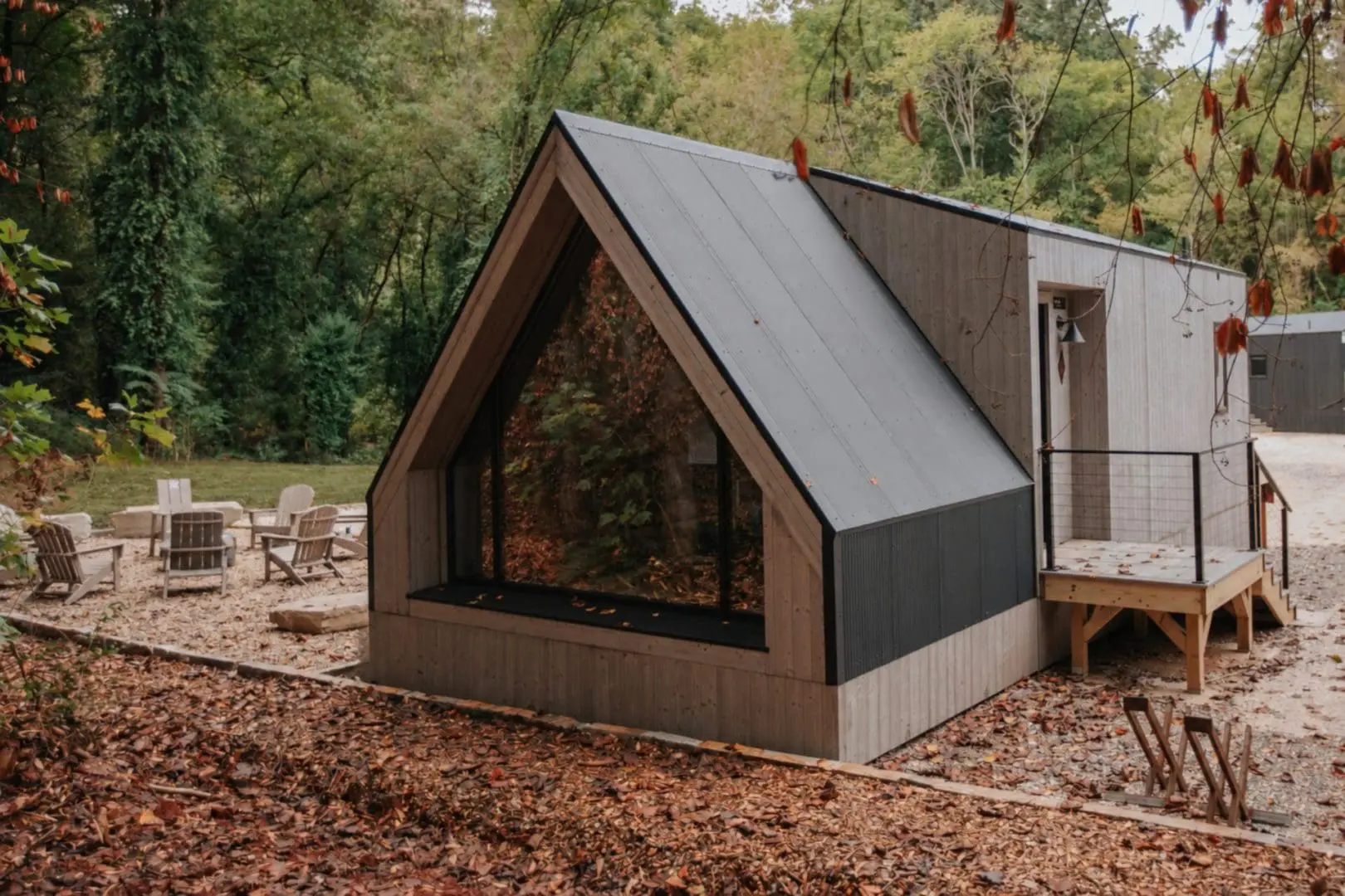
Accommodations range from The A-Frame Studio (king bed, full kitchen, soaking tub, and sleeper sofa — sleeps four) to The Bunkhouse, The Nook, The Luna, and integrated Pull Inn sites for van and camper travelers. The site is designed without hierarchy: every accommodation type shares the same fire pits, common spaces, and trail access. Van lifers and studio guests end up at the same fire, which is usually more interesting than staying separate.
After the ride, South Knoxville’s food and drink scene is within reach. Kerns Food Hall is 2.4 miles from the property. Market Square is a short drive downtown. The logistics of the post-ride evening are handled without any of the usual trade-offs between trail access and city proximity.
That’s the whole idea. A Knoxville retreat shaped by the city and the wild.
Your Trailhead Has a Front Door
Eighty miles of trail. Downtown Knoxville minutes away. Dogs welcome. The Drop Inn puts you in the middle of the Urban Wilderness, so your ride starts when you walk outside and ends when you walk back in.


